
Project: iVine, the vineyard's digital twin to support winegrowers
The vineyard’s digital twin to support winegrowers’ decisions
Introduction
iVine is a two-year project (2023-2024), funded by the Tuscany Region RDP 2014-2020 – sub-measure 16.2, aimed at testing, validating and trialling a mobile DSS app for streamlining vineyard management and optimising and reducing the use of pesticides, in order to reduce environmental impact, safeguard the health of workers and rural populations, and reduce management costs for farms.
The project is led by Agrobit, with the participation of the University of Florence (DAGRI), the National Research Council’s Institute of BioEconomy (CNR-IBE), CIA (Italian Farmers’ Confederation Tuscany), Mulini di Segalari (a winery in Bolgheri), Felsina (a winery in Chianti Classico) and the regional Demo Farm Tenuta di Cesa.
Project objectives
The project’s objectives can be summarised as follows: 1. Validate a mobile DSS app capable of supporting the agronomist/farmer in quickly and objectively assessing the development of the aerial structure of tree crops, particularly vines, in order to optimise canopy management operations and the distribution of agronomic inputs, such as pesticides but also foliar fertilisers and water 2. Monitor the effectiveness of treatments, pesticide and water consumption highlighted by using the app, and the costs required at the various stages to achieve the set objectives; 3. Assess the cost/benefit efficiency and the environmental and economic impact produced by using the app and by optimised pesticide distribution, compared with traditional management, in wine businesses of different sizes and in different regional wine-growing areas.
How the iAgro app works
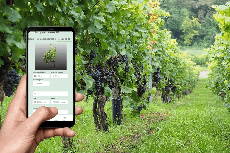
The iAgro app, installed on a smartphone, allows the operator to carry out a 3D scan of the plant under investigation automatically, quickly and easily. During this process, the app uses the smartphone’s camera and augmented reality (AR) algorithms to acquire all the necessary information, also making use of the smartphone’s built-in motion and position sensors. These sensors allow the app to record changes in the device’s position and orientation during the scan. The app also georeferences all the information acquired, i.e. it links the detected data to the position of each plant. Once acquisition is complete, thanks to artificial intelligence (AI) and computer vision (CV) algorithms, the app automatically returns the canopy’s biometric parameters (thickness, height, volume, LAI) and generalised vineyard parameters (LWA, TRV) (Fig. 1). This information is then automatically used to generate prescription maps to optimise crop protection treatments, reducing environmental impact, safeguarding people’s health and improving the economic sustainability of wine businesses.
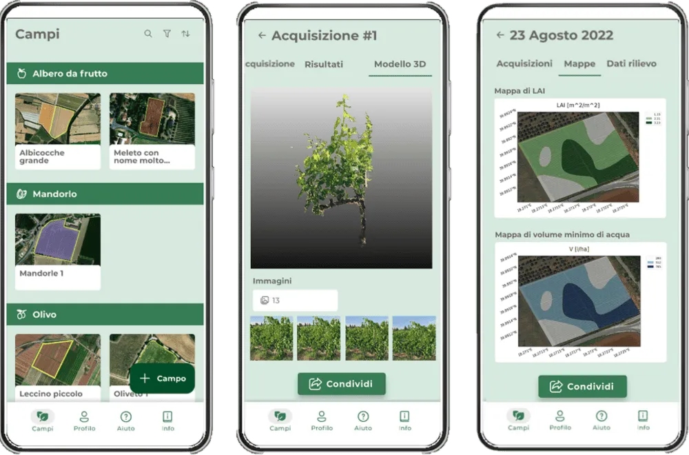
Fig.1: Screenshots of the iAgro app, tested and validated as part of the iVine project.
Field surveys
Once the test vineyards had been identified, the vineyard was divided into 2 equal areas for monitoring (Fig.2). In one plot, the farm’s traditional fixed-rate crop protection treatments were applied; in the other, variable-rate treatments were applied, as suggested by the iAgro app.
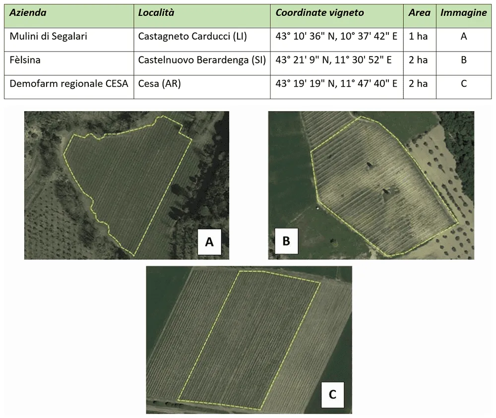
Fig.2: Test vineyards with their size and location.
During the project’s implementation, various technologies and methodologies were adopted to carry out the app’s validation analyses. Specifically, the surveys were carried out at three different phenological stages.
Agrobit monitored ten sample plants for each study area using the iAgro app. Thanks to the app, it was possible to generate vineyard vigour maps, by calculating vegetation indicators such as the LAI (Leaf Area Index), as well as the canopy’s biometric parameters, including its height, thickness and volume (Fig. 3).
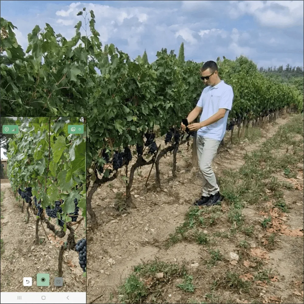
Fig.3: Survey using the iAgro app on a Sangiovese vineyard row.
To assess the app’s effectiveness and validate it, the results obtained were correlated with data obtained from CNR-IBE and the University of Florence (DAGRI): – CNR-IBE used a drone with a multispectral sensor and RGB/LiDAR to generate vigour maps using vegetation indicators (NDVI) and estimate biometric leaf development parameters, such as canopy height, thickness and volume, from the generated 3D point clouds; – The University of Florence (DAGRI) used a proximal multispectral sensor (OptRx) mounted on a quad bike to assess vigour using vegetation indicators (NDVI, NDRE), and a LiDAR sensor to assess biometric leaf development parameters, including canopy height, thickness and volume. A D-GNSS receiver was used for precise geolocation of the data collected.
For each of the methods used (smartphone, drone, quad bike), vigour maps and biometric maps were created in three classes reflecting the characteristics of the plants in the test area. The results showed good correlations between the vigour and biometric parameters obtained from the three methods used, suggesting that the app is reliable in estimating these parameters.
Finally, using data from the smartphones, prescription maps to optimise crop protection treatments were developed, with zoning into two/three classes to carry out variable rate treatments (VRT) (Fig. 4).
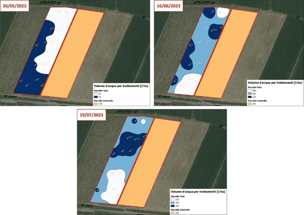
Fig.4: Prescription map generated by the iAgro app at the three phenological stages in the two zones, with respective values for variable-rate application (in shades of blue) and fixed-rate application (in orange) in the control plot.
Effectiveness of variable rate treatments (VRT)
The iAgro app makes it possible to obtain prescription maps for crop protection treatments that can be loaded directly onto VRT machinery. During the project, in order to verify the cost/benefit efficiency and the environmental and economic impact produced by using the app, tests were carried out to assess the differences between the farm’s traditional treatments (fixed volume) and those recommended by the iAgro app (variable rate). The tests were carried out using water-sensitive paper and a tracer product, following the internationally standardised procedure (ISO 22522).
Specifically, the tests involved: 1. Quantitative assessment of liquid distributed at the different phenological and growth stages; 2. Quantitative assessment of deposition using a tracer during spraying, followed by leaf sampling and verification of surface area/deposition.
Conclusions
The first year of the iVine project’s experimentation showed promising results, representing a significant step towards optimising vineyard management, particularly in reducing pesticide use and environmental impact.
The advantage of using the app lies in low-cost, ongoing monitoring of plant biometric parameters, with detailed maps available that make it possible to make informed decisions about the vineyard, based on digital, objective data recorded over time.
In light of the successes achieved in the first year, the next year of experimentation will focus on applying the same protocols while awaiting final results. Ongoing collaboration between all project partners will ensure an integrated, multidisciplinary approach, thereby helping to promote environmental and economic sustainability in the wine sector.
Visit the project website: https://ivine.ciatoscana.eu/
Discover the iAgro app and try it for free!