
Project: VineScale, a drone platform for advanced vineyard monitoring
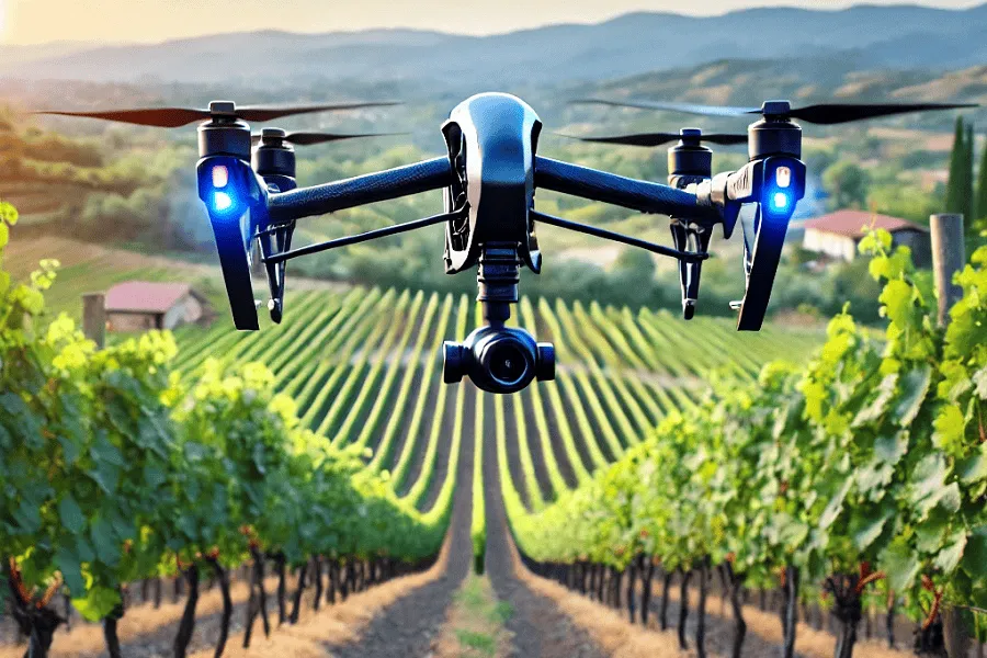
Vineyard monitoring with drones
Introduction
Precision viticulture is making giant strides thanks to new technologies based on advanced analysis of drone-derived data. In this context, the VineScale sub-project, part of the Chameleon project, aims to revolutionise vineyard monitoring through the analysis of drone-derived images. The goal of the VineScale project is to test and validate Chameleon’s automated drone data analysis tool, verifying its effectiveness and reliability across different application scenarios, on 12 vineyards spread across Italy (Fig. 1).
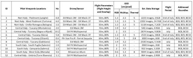
Fig.1: Summary of the VineScale project flights.
To ensure the validity of the information obtained from Chameleon’s automated system, the VineScale results were compared with data collected directly in the field.
Automatic detection of grapevines
Among the tools offered by the Chameleon platform is the automatic detection tool for identifying vines. By analysing a 3D point cloud derived from processing images taken by drone during the leafless period, the tool can generate a vector mask that identifies every plant in the field.
This tool proved effective, but it highlighted the need to specify acquisition guidelines, such as flight altitude, overlap and grid pattern (e.g. double-grid flight), in order to obtain an adequate dataset and correctly process the data.
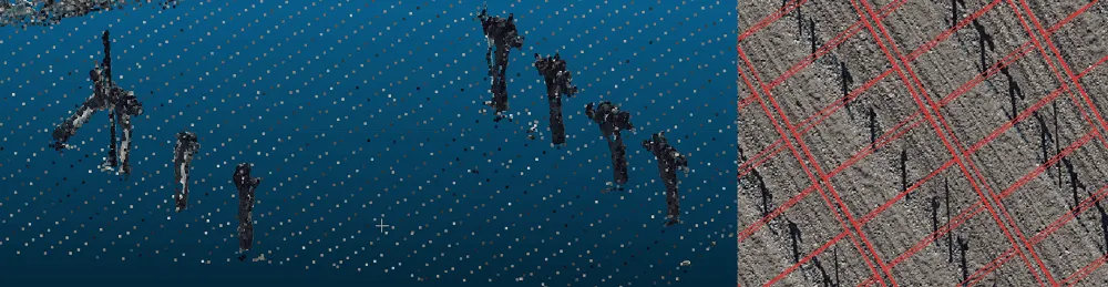
Fig.2: Point cloud of individual extracted plants (left) and plant mask (right)
Monitoring crop growth using RGB information
Once the masks have been generated (automatically or manually), it is possible to test another algorithm that makes it possible to monitor the canopy volume of each individual plant. By comparing the vine canopy volume estimates obtained using the Chameleon tool with manual measurements of plant thickness and height, a consistent pattern emerged (Fig. 3, 4). The differences are due to simplifications in the volume calculation, but overall the method proved highly reliable for growth monitoring. By interpolating the values for each individual plant, it is possible to generate thematic maps representing the situation in the field.
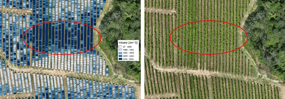
Fig.3: Results of the algorithm for calculating the volume of each individual plant.
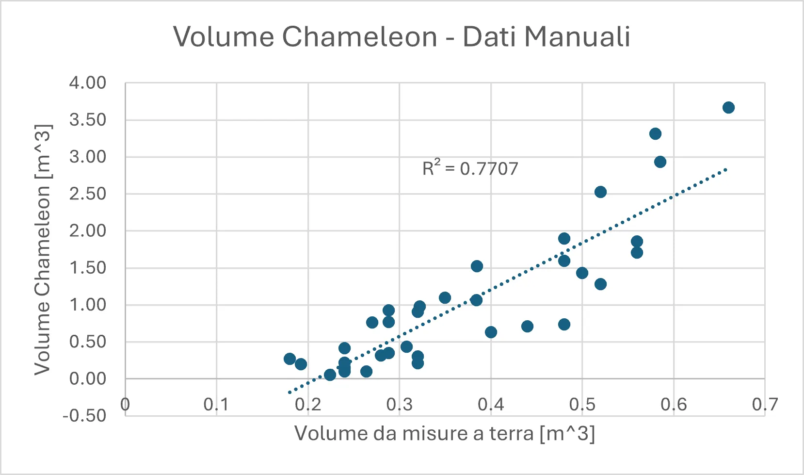
Fig.4: Correlation between data estimated by the Chameleon tool and ground-collected data.
Detecting water stress in vines
Water stress analysis is carried out using thermal images and vegetation segmentation techniques, calculating the Crop Water Stress Index (CWSI) for each vine based on temperature. This made it possible to obtain fundamental data on the water status of the plants very quickly, in order to improve irrigation management. To accurately estimate CWSI values derived from thermal data, air temperature and humidity data were used as a reference to ensure the system worked correctly.
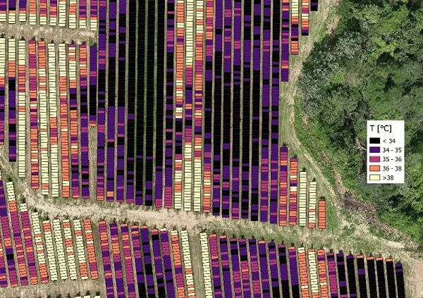
Fig.5: Temperature results for each plant.
Vine analysis from multispectral information
Using multispectral orthomosaics, the system made it possible to precisely highlight vine vigour, making crop segmentation and monitoring faster than traditional methods. In addition, soil zoning maps derived from drone data were compared with physical sampling. Using a correlation coefficient (Pearson), the similarity between the maps generated by the tool and the data collected in the field was assessed, confirming the reliability of the zoning method.
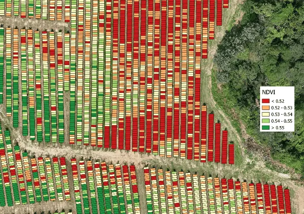
Fig.6: NDVI for each individual plant.
Conclusions and future prospects
The VineScale project demonstrated the potential of using drones for precision viticulture, offering an innovative tool for vine monitoring, growth analysis and water resource management. Although some challenges emerged, the results obtained show a promising future for integrating these technologies into modern vineyard management.
A key element of the project is that the Chameleon system made it possible to analyse around 44.6 hectares and 129,636 plants in 33,752 seconds (around 9 hours). This system calculated numerous indices and biometric measurements, including NDVI, temperature, CWSI and canopy volume, at a speed unthinkable compared with manual measurements. Indeed, while traditional surveying of these parameters would require days of work and considerable labour, the use of drones and advanced algorithms made it possible to carry out a fast, complete and detailed analysis.
With further improvements to the algorithms, the effectiveness of these tools can become even greater, leading to increasingly smart and sustainable viticulture.